Aktuelni El Niño se razvija u najtoplijem klimatskom okruženju do sada, što otežava precizna predviđanja. Naučnici upozoravaju da kombinacija vrlo snažnog El Niña i globalnog zagrevanja može pojačati ekstremne padavine i suše, ali tačni regionalni efekti ostaju neizvesni. Događaj, čiji se vrhunac očekuje između oktobra i januara, predstavlja i važnu priliku za bolje razumevanje buduće klime.
El Niño U „Neistraženom“ Okruženju: Šta Nas Može Očekivati Dok Se Rekordni Event Sukobljava Sa Globalnim Zagrevanjem
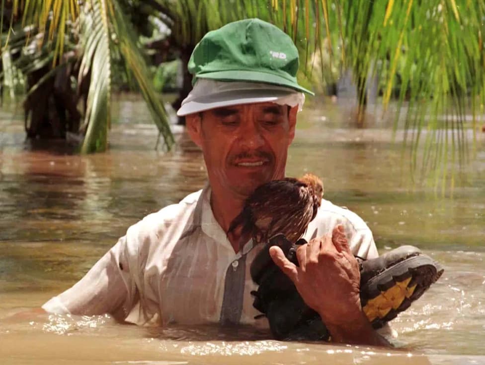
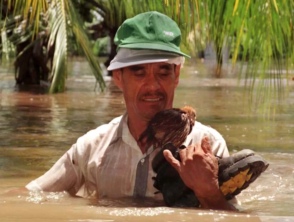
A man carries a small chicken, perched on a shoe, from his flooded home in the village of Gomera, Escuintla, south of Guatemala's capital, on Sept. 30, 1997. Two rivers in the Escuintla area overflowed after heavy rain during El Niño, flooding over 800 homes. Another El Niño is strengthening in the Central and Eastern Pacific in June 2026, and likely to affect weather patterns around the globe in the months ahead. See impacts from previous events in the U.S. and worldwide in the following photos.(Reuters)
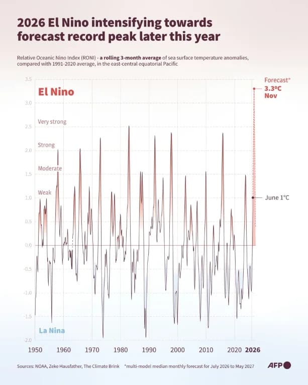
Meteorolozi obično oslanjaju sezonske prognoze na istorijske obrasce, ali aktuelni razvoj El Niña događa se u klimi toplijoj nego ikada zabeleženo — što čini predviđanja manje pouzdanim nego ranije. Naučnici upozoravaju da kombinacija izuzetno snažnog El Niña i dugotrajnog globalnog zagrevanja može pojačati ili promeniti poznate obrasce padavina i suše širom sveta.
Zašto je ovo „neistraženo područje“?
Ben Kirtman, dekan Rosenstiel School of Marine, Atmospheric, and Earth Science (University of Miami), kaže:
"Nalazimo se u nekom obliku neistraženog područja."El Niño je dobro proučen fenomen, kao i efekti klimatskih promena, ali pitanje kako će snažan El Niño delovati u današnjoj mnogo toplijoj globalnoj klimi ostaje otvoreno.
Šta znamo i šta ne znamo
Istorijski, tri događaja u poslednjih 50 godina smatrani su "ekstremnim": 1982–83, 1997–98 i 2015–16. Stručnjaci, poput Micheala McPhadena (bivši naučnik NOAA), procenjuju da aktuelni El Niño može dostići slične ili veće magnitude od tih prethodnih događaja. Ipak, odgovor atmosfere i regionalne posledice — posebno kako će se kombinovati sa višim pozadinskim temperaturama — ostaju neizvesni.
Koje efekte možemo očekivati?
- Toplija atmosfera može zadržati više vlage, pa regije koje obično dobijaju više kiše tokom El Niña, danas mogu iskusiti ekstremnije padavine i poplave.
- S druge strane, veće temperature ubrzavaju isparavanje i sušenje tla, pa suše koje bi bile jake mogu postati izuzetno ozbiljne.
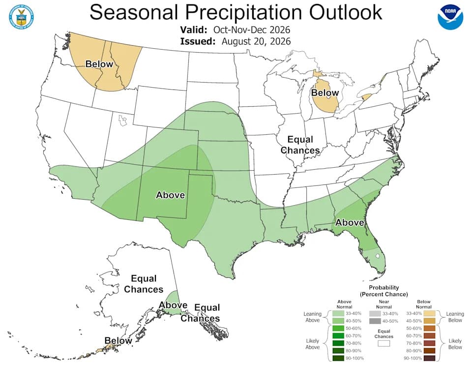
- Moguće su neočekivane promene u tipičnim obrascima: iako postoje uobičajeni znakovi El Niña (npr. vlažnija zima na jugu SAD), naučnici upozoravaju da signali ove godine možda neće slediti istorijske obrasce u potpunosti.
Regionalne neizvesnosti
Daniel Swain (University of California) smatra da je događaj dovoljno potentan da bi standardni uticaji El Niña mogli biti pojačani, posebno u južnim državama SAD i južnoj Kaliforniji. Ben Kirtman, međutim, ostaje oprezan i ističe da jači El Niño ne garantuje nužno proporcionalno veće uticaje — jer atmosfera i okeani mogu odgovoriti složenije nego što pretpostavljamo.
Prilika za nauku
Emily Becker i drugi naučnici naglašavaju da je aktuelni događaj i vredna prilika za proučavanje kako će klima izgledati u narednih 10–15 godina. Posmatranje interakcije ekstremnog El Niña i već povišenih temperatura može otkriti nove obrasce i pomoći u unapređenju modela i pripreme za buduće promene.
Šta pratiti
- Vrh El Niña se očekuje između oktobra i januara; pratite ažuriranja NOAA, Copernicus i lokalnih meteoroloških službi.
- Obratite pažnju na upozorenja o poplavama i sušama u regijama koje su istorijski pod uticajem El Niña.
- Očekujte iznenađenja: naučnici predviđaju da će tokom događaja verovatno biti neočekivanih posledica, kako negativnih, tako i neutralnih ili lokalno povoljnih.
Autor izvorne priče: Tekst zasnovan na izveštaju USA TODAY i izjavama više klimatskih naučnika. Ovo je sažetak i prilagođeni prikaz koji ističe ključne naučne nalaze i implikacije za globalnu klimu.
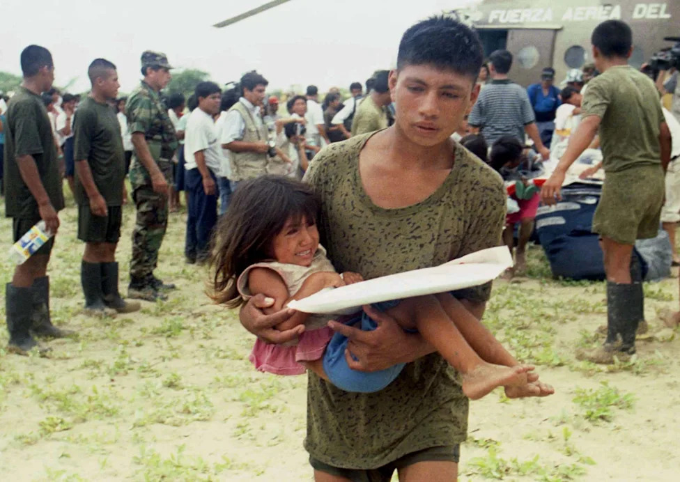
A Peruvian soldier evacuates a child victim of flooding in Piura, north of Lima, Peru, on Jan. 10, 1997, during flooding influenced by El Niño.(Silvia Izquierdo, Reuters)
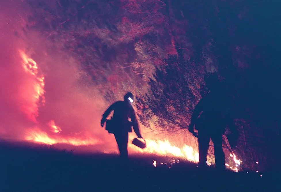
Lorenzo Macias and Darren Davis with the Stanislaus Hot Shots from California start a back fire along Clyde Morris Boulevard in Daytona Beach on July 1, 1998 to stop a large fire burning toward the city. Research later linked the 1998 firestorms in Florida to the exceptional El Niño that suddenly halted and transitioned to a La Niña.(David Tucker, Daytona Beach News-Journal)
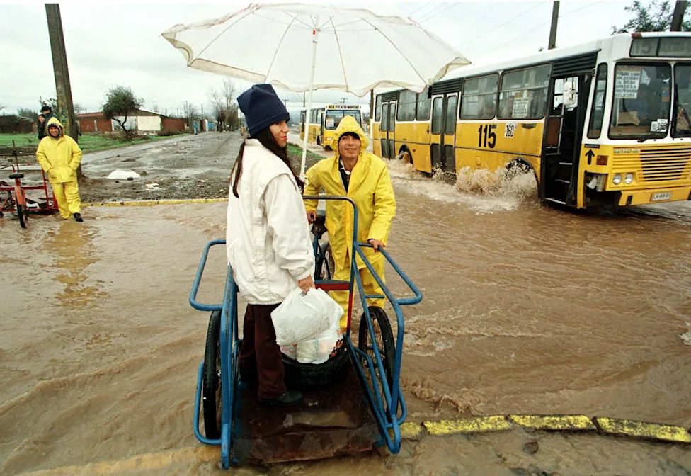
A woman uses a cycle-cart to cross a rain-flooded street in the outskirts of Santiago, June 23, 1997. At least 18 people died and more than 50,000 people nationwide were left homeless after heavy rain, a side effect of El Nino.(Reuters)
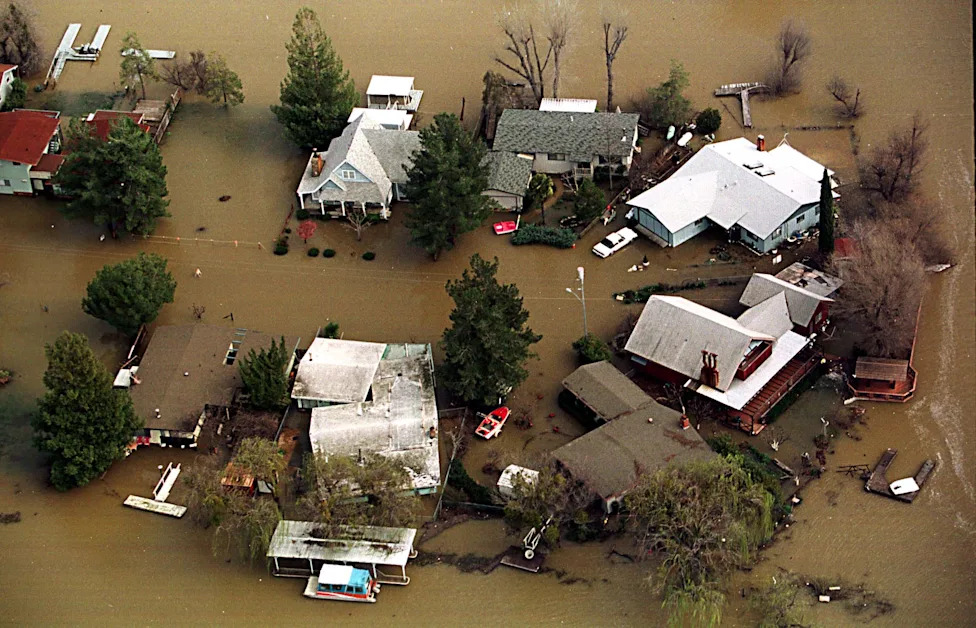
A cul-de-sac of homes is partially submerged in flood waters as Clear Lake continues to rise on February 24, 1998. El Niño influenced rains caused the lake to rise to its highest levels since 1914.(Sean Ramsey)
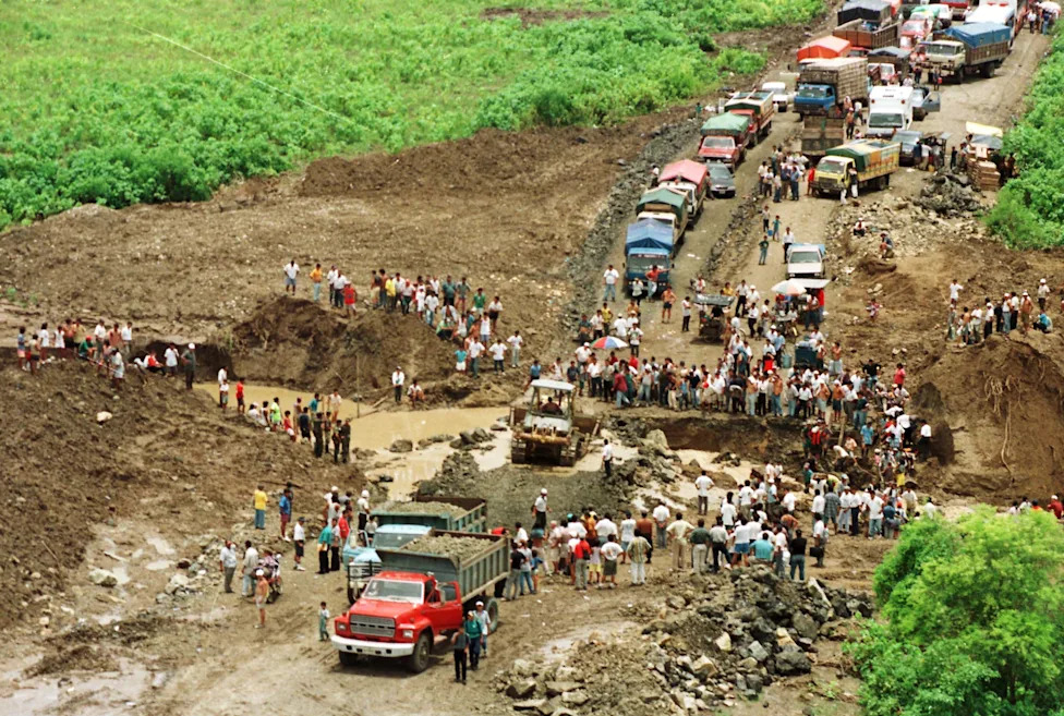
Construction crews try to repair a road destroyed by flooding due to El Niño on May 5, 1998. Authorities reported the country had suffered $1.925 million in damage due to the storms.(Reuters)
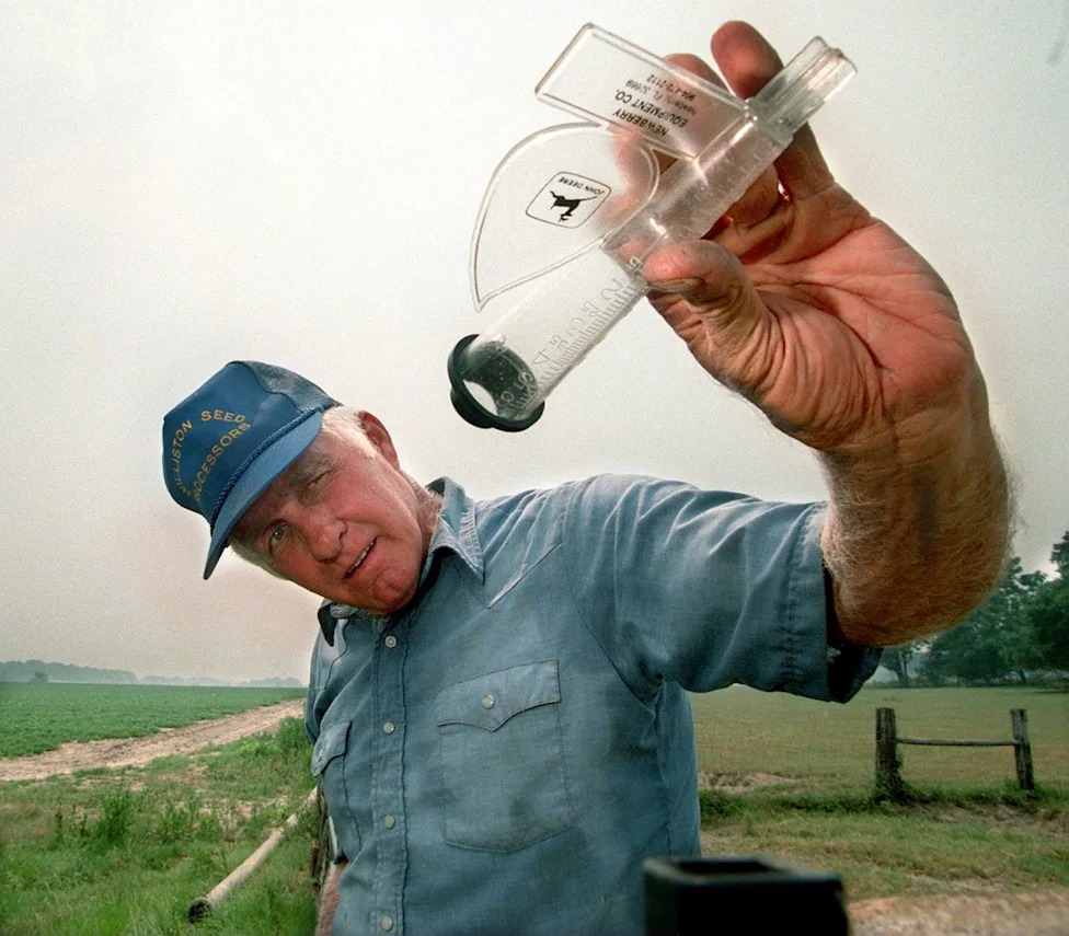
D.A. Lewis checks his rain gauge after irrigating his 40 acres of peanuts in Marion County, Florida on June 23, 1998. "Yup, no rain," Lewis said sarcastically. Lewis only planted half of what he normally plants because of the dry conditions. "I don't call this El Nino, I call it Hell Nino."(Doug Engle, Star-Banner)
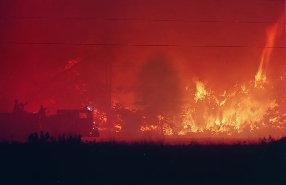
Firefighters direct a water cannon at the head of a wildfire trying to slow its approach toward the evacuated Cedar Highlands subdivision in Daytona Beach, Florida, on the morning of July 2, 1998.(Sam Cranston, Daytona Beach News-Journal)
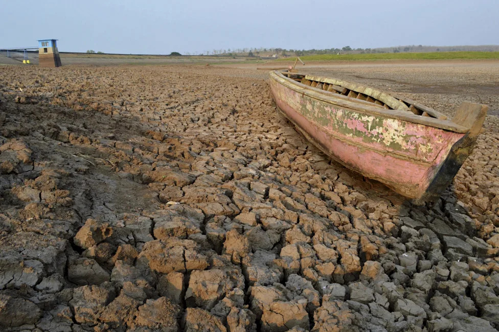
The influence of El Niño was blamed for a drought in Indonesia's East Java province that left this boat stranded on a dry, cracked riverbed of the Dawuhan Dam during drought season in Madiun on Oct. 5, 2015.(Antara Foto, Reuters)
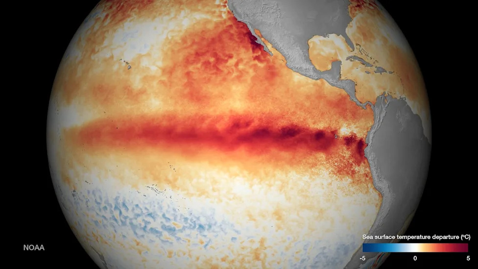
Sea surface temperature departure is seen in an undated NOAA image released Oct. 9, 2015 as El Niño strengthens.(Reuters / NOAA)
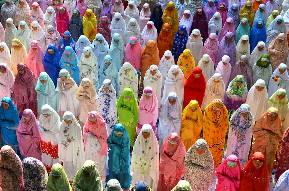
Female students attend a mass prayer session to ask for rain, in Kudus, Indonesia's Central Java province on Oct. 17, 2015.(Yusuf Nugroho, Antara Foto, Reuters)
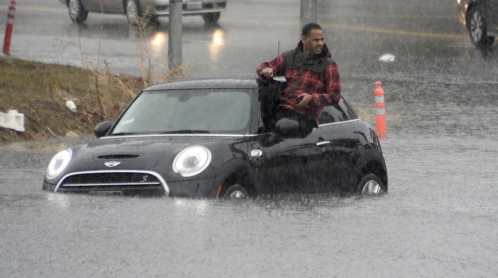
A driver climbs out of a window of his car after driving onto a flooded road in Van Nuys, California, Jan. 5, 2016. An El Nino-strengthened storm brought widespread rain to drought-stricken California, triggering flooding that clogged roadways, and authorities warned residents about possible mud slides.(Gene Blevins, Reuters)
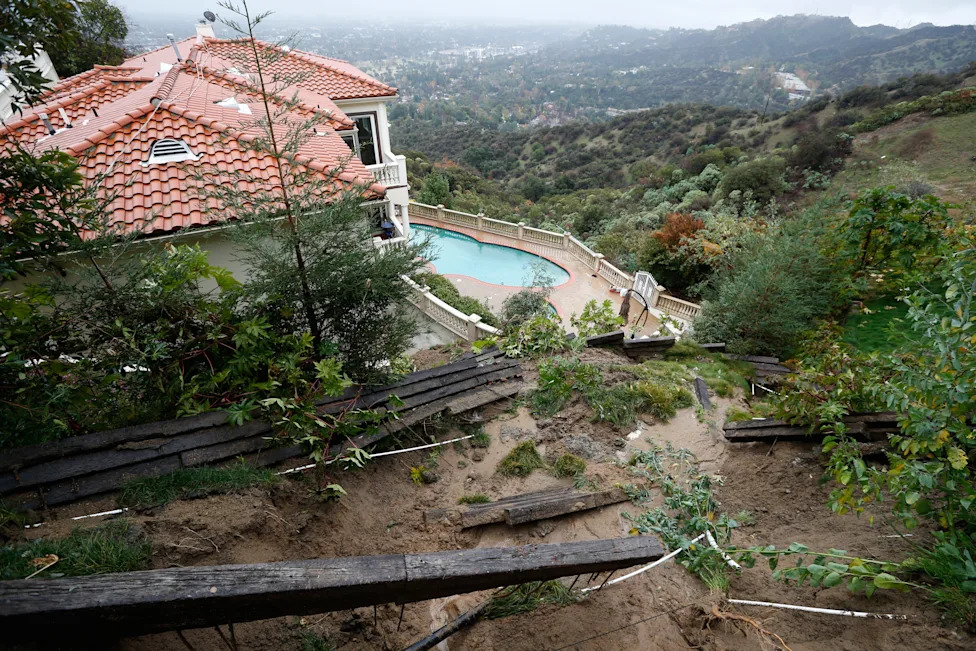
A home with a fence destroyed by a mudslide is seen on Jan. 6, 2016, after an El Nino-strengthened storm brought rain to Pasadena, California.(Lucy Nicholson, Reuters)
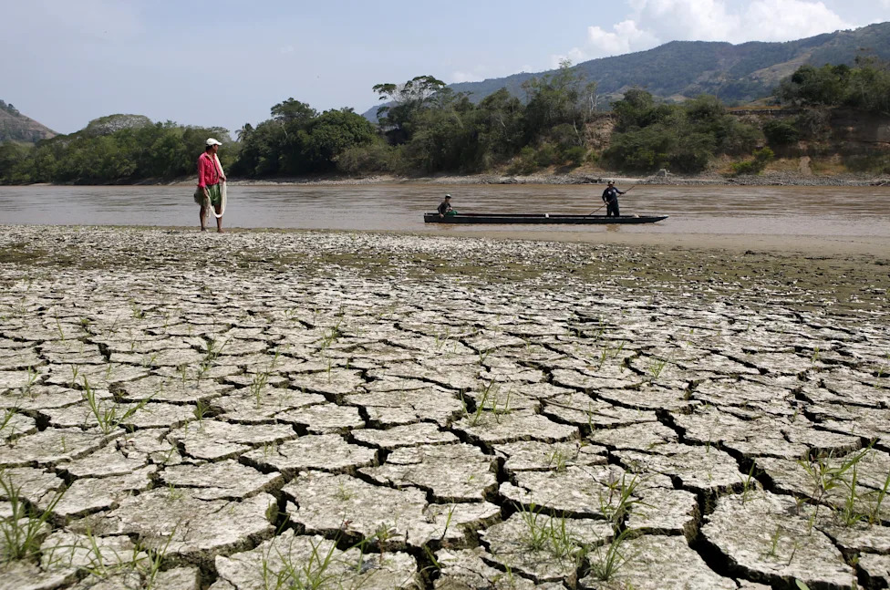
Fisherman Gabriel Barreto stands on the shore of the Magdalena river, the longest and most important river in Colombia, in the city of Honda, Jan. 14, 2016.(John Vizcaino, Reuters)
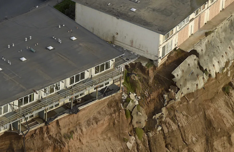
Uninhabitable apartments, in danger of collapsing into the Pacific Ocean, line Esplanade Ave. in Pacifica, California on Jan. 26, 2016.(Noah Berger, Reuters)
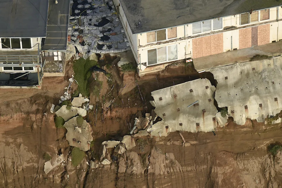
Uninhabitable apartments, in danger of collapsing into the Pacific Ocean, line Esplanade Ave. in Pacifica, California on Jan. 26, 2016.(Noah Berger, Reuters)
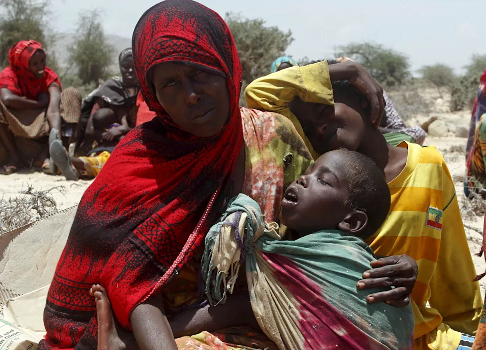
A displaced woman and her children wait for assistance at Habaas town of Awdal region, Somaliland on April 9, 2016. Across the Horn of Africa, millions were hit by the severe El Nino-related drought.(Reuters / Feisal Omar)
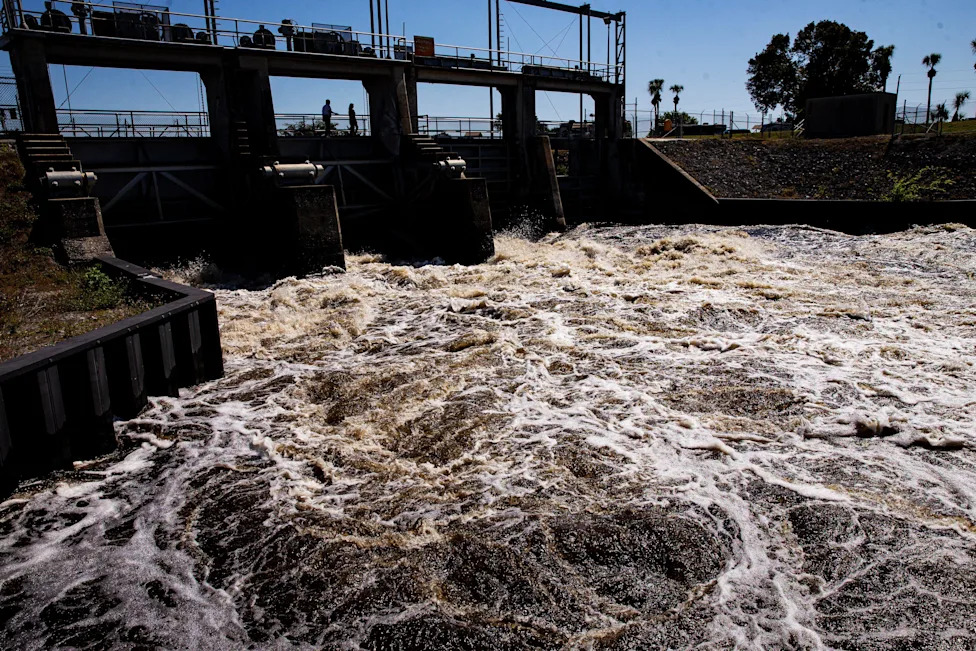
Water rushes through the Ortona Locks on the Caloosahatchee River on Monday, Feb. 26, 2024, as the Army Corp of Engineers releases water from Florida's Lake Okeechobee during continued El Nino conditions.(Andrew West/The News-Press, USA TODAY Network)
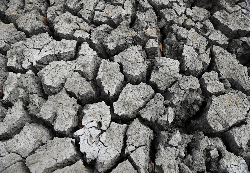
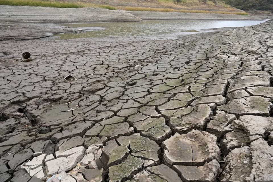
A view of cracked ground at a dam in Mudzi, Zimbabwe on July 2, 2024, during an El Nino-influenced drought, resulting in malnutrition among children under the age of five, pregnant and lactating women, and adolescents.(Philimon Bulawayo, REUTERS)
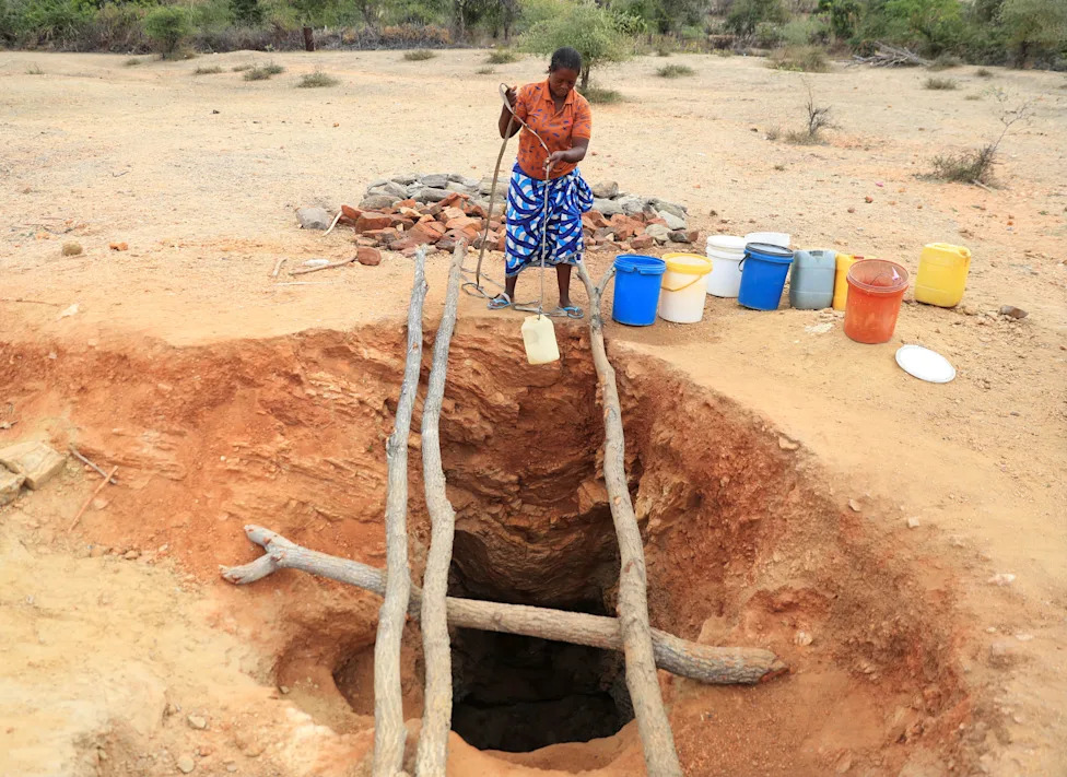
A woman fetches drinking water from an unprotected well on July 2, 2024 in Kotwa, in the Mudzi district of Zimbabwe during an El Nino-influenced drought.(Philimon Bulawayo, REUTERS)
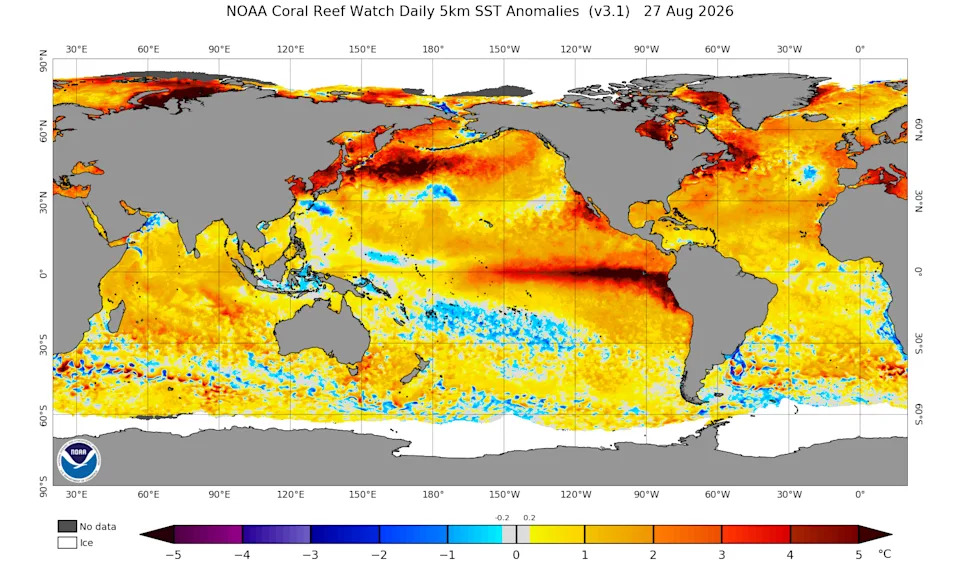
A chart of sea surface temperature anomalies across the world on Aug. 27, 2026 illustrate how much warmer than normal temperatures are across much of the world's oceans.
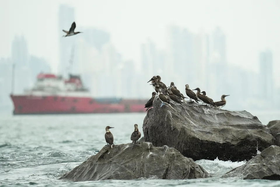
Adult and immature blue-footed boobies rest on rocks near the entrance to the Panama Canal as seabirds native to the cold, nutrient-rich waters off Peru and Chile appear outside their usual range while El Nino warms the eastern Pacific and disrupts marine food supplies, off the coast of Panama City, Panama, August 5, 2026. The Panama Canal Authority has announced plans to cap daily transits in September because of El Niño-related drought concerns.
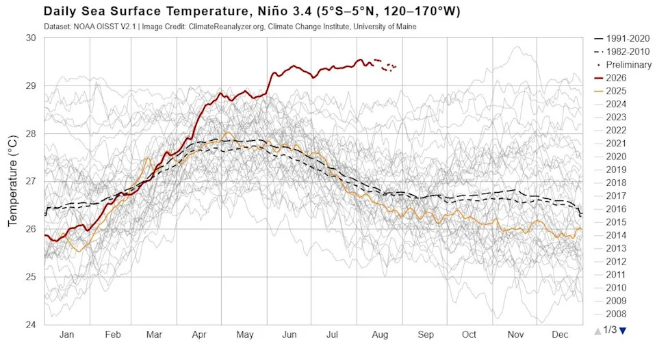
Sea surface temperatures in the El Niño region of the Pacific Ocean continue to set daily records, according to the Climate Reanalyzer with the University of Maine's Climate Change Institute, using data from the National Oceanic and Atmospheric Administration.
Pomozite nam da budemo bolji.